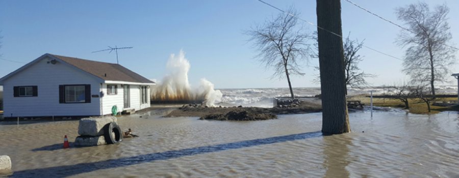
Weather forecasts are calling for strong south to southeast winds this evening through until tomorrow evening. Winds are expected to peak tomorrow morning with sustained wind speeds in the range of 35 km/hr to 40 km/hr and gusts of up to 60 km/hr. Wave heights are predicted to be between 1 m and 1.5 m during this period.
The southeast winds will be driving waves directly onshore for most of the Lake Erie shoreline in the Lower Thames jurisdiction. There is a risk that wave action could damage shoreline protection works and cause shoreline erosion in vulnerable areas. Last year flooding had occurred along Erie Shore Drive in Chatham-Kent when the area experienced sustained winds above 35 km/hr from a southerly direction (southeast through southwest). Therefore, the forecasted wind speeds and direction tomorrow morning could cause flooding in this area. Residents in vulnerable areas along the Lake Erie shoreline should pay attention to local conditions.
People should take extra caution and avoid the shoreline should conditions get rough. The waves can be strong and the shoreline slippery. There could also be hazardous debris within the waves and water which could be thrown onto the shoreline. Standing water and ice can also present their own unseen hazards. Children, pets and livestock should be kept away from the water. Officials will continue to monitor the situation and update this advisory if necessary.
Contact: Jason Wintermute (519-354-7310 x227, [email protected]) regarding this message.
This message will be in effect until March 28th, 2018.

