Highlights:
• Special Weather Statement has been issued for the region due to significant amounts of mixed precipitation and strong winds overnight and Wednesday.
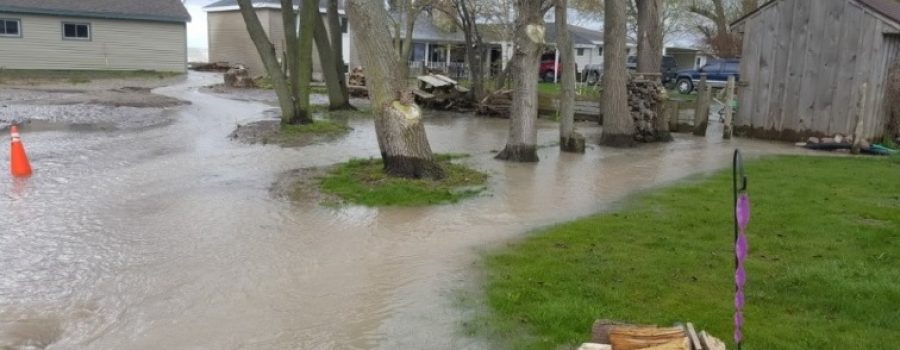
• Potential for localized flooding due to rainfall and melted snow.
• Local watercourses likely to rise tomorrow and some may spill their banks.
• Potential for shoreline damage and flooding from wave spray tomorrow afternoon and evening
• Drop in temperature tomorrow night could lead to dangerous icy conditions.
Message:
A Special Weather Statement has been issued by Environment Canada. Snow is expected to start this evening turning into freezing rain and then eventually rain as temperatures rise. Depending on the area of the watershed, forecasts are calling for 15 to 35 mm of rain in total by tomorrow evening. There is currently between 10 and 15 mm of water stored in the snow. Temperatures are expected to rise to 4 C tomorrow afternoon. Strong winds from the south and southwest are expected tomorrow afternoon and evening with sustained winds exceeding 30 km/hr. Peak winds of over 45 km/hr with gusts over 70 km/hr are expected tomorrow afternoon. Temperatures are then expected to drop beneath freezing overnight tomorrow. Waves on Lake Erie could reach 2 m in height tomorrow.
The large amount of rain predicted could lead to localized flooding in areas of poor drainage. On top of this, the rain and high temperatures could melt most of the snow producing even more water. The frozen ground conditions suggest that almost all of this will run off into the local watercourses. Local watercourses will rise throughout the day tomorrow, and some could spill their banks and flood low lying adjacent areas. As temperatures drop back beneath freezing tomorrow night, some of this water could freeze in place. Depending on how the event plays out, the LTVCA may need to operate the Indian-McGregor Creek Diversion Channel in order to protect the south end of the City of Chatham.
Strong winds from the south and southwest tomorrow afternoon and evening will be driving waves onshore along most of the Lake Erie shoreline in Chatham-Kent and Elgin County. There is a risk that wave action could damage shoreline protection works and cause shoreline erosion. Flood prone areas such as Erie Shore Drive in Chatham-Kent could be expected to see some flooding due to wave crashing against shoreline protection works and spraying water up onto the land. Although currently the predicted times of highest winds don’t align with times of freezing temperatures, however, should this change there could be freezing spray. Any water left behind on the land could freeze in place. Residents along the Lake Erie shoreline should pay attention to local conditions and prepare accordingly.
The Thames River can be expected to rise some due to the rain and snowmelt. Should the higher rainfall amounts appear, there could be some flooding in the most low lying areas adjacent to the river, such as the sidewalk in downtown Chatham, later in the week.
People should take extra caution and avoid the river, ditches, streams and shorelines. On our local watercourses, the combination of slippery banks and fast moving water can be dangerous. Along the shoreline, waves can be strong and the shoreline slippery. There could also be hazardous debris within the waves and water which could be thrown up onto the shoreline. Standing water can also present its own unseen hazards. When the water freezes, there could be icy hazardous conditions. Children and animals should be kept away from the water. Officials will continue to monitor the situation and update this advisory if necessary.
Contact: Jason Wintermute ([email protected]) (519-354-7310 x227) regarding this message.
This message will be in effect until January 25, 2019.

