Highlights:
• Warm temperatures are expected this weekend and 15 to 20 mm of rain are expected Saturday evening and overnight.
• Local ditches, creeks and streams are expected to rise and could spill their banks.
• The Thames River is expected to flood the low lying river flats adjacent to the river, from Delaware down to Chatham, including the sidewalk in downtown Chatham.
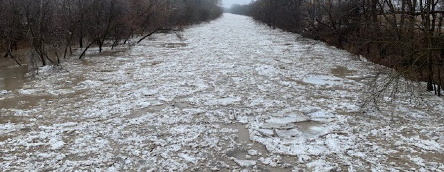
• Ice is expected to break up on the Thames River.
• High water levels are expected throughout the week.
Message:
Spring like weather is expected to arrive this weekend. Saturday afternoon temperatures are expected to rise and remain above freezing throughout the weekend. Significant rainfall is also forecasted for Saturday evening and overnight with a total of 15 to 20 mm of rain expected. The snowpack in the west of the Lower Thames watershed likely contains around 10 mm of water equivalent, with increasing amounts moving east, and the snowpack in the Upper Thames likely contains over three times that.
The ice jam that had formed in February has largely flushed out or melted away. However, freezing temperatures over the last couple of weeks have put 5 to 10 cm of new ice on the Thames River. This is about half the ice thickness the river had before the ice jam occurred in February.
The warm temperatures and rain are expected to melt the remaining snowpack in the Lower Thames watershed. On the region’s ditches, creeks and streams, water levels will rise and many could reach bank full conditions or spill out into their floodplains. Blockages of ice, snow and debris could also cause localized flooding on these smaller watercourses. Water levels should be expected to remain high into early next week. The LTVCA expects to have to operate the Indian-McGregor Creek Diversion Channel on Sunday in order to protect the south end of the City of Chatham.
The Thames River is also expected to rise with the warm temperatures and rain. While there is some uncertainty as to how the water in the snowpack in the Upper Thames watershed will release, almost all the snow is expected to melt out of the Lower Thames watershed. Water levels on the river will begin to rise on Sunday and remain high throughout the week. Water levels are expected to rise and flood the low lying river flats from Delaware down to Chatham including the sidewalk in downtown Chatham. Flows are also expected to break up the ice on the river. The flood protection works downstream of Chatham were designed to safely pass the expected flow assuming the ice does not jam up, and although an ice jam has not been previously observed with such a thin ice cover, caution is required given the recent ice jam in February.
People should take extra caution and avoid the river, ditches, and streams. The combination of slippery banks, broken or unstable ice and fast moving cold water can be dangerous. Standing water can also present its own unseen hazards. Children and pets and livestock should be kept away from the water.
Officials will continue to monitor the situation and update this advisory if necessary.
This message will be in effect until March 12th, 2019.
Contact: Jason Wintermute (519-354-7310 x227, [email protected]) regarding this message.

