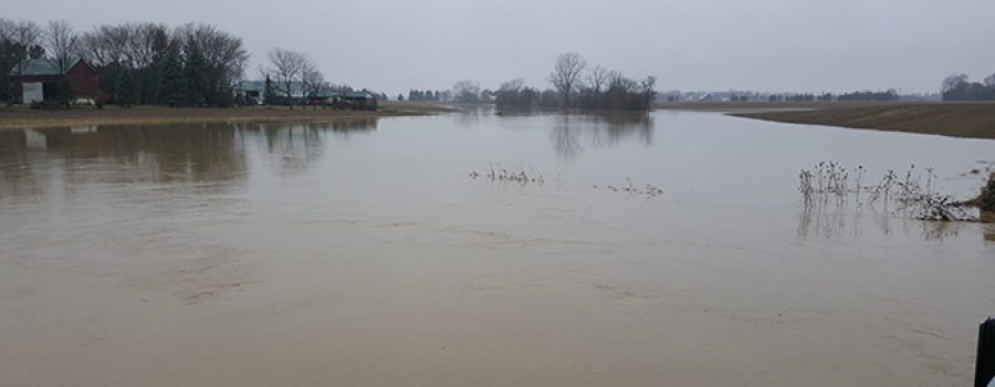
Last night the Lower Thames watershed experienced widespread rain and thunderstorm activity. Rain gauges in the area generally showed between 10 and 15 mm of rain and radar rainfall estimates suggest some areas may have received over 25 mm. Some areas may have received even more due to the thunderstorm activity. Rainfall forecasts are calling for another 10 mm of rainfall today, another 5 to 10 mm this evening and overnight, and perhaps another 5 mm on Friday during the day. Weather radar shows that there is still the potential for significant thunderstorm activity with this system and those thunderstorms could raise total rainfall amounts even higher than those predicted.
The Watershed Conditions – Safety Bulleting issued yesterday for Erie Shore Drive is still in effect.
Water levels on the smaller local watercourses throughout the watershed can be expected to rise due to the rainfall already received. With the additional rainfall predicted, some of those watercourses could rise and spill their banks. With the rainfall totals already received on and predicted for the McGregor Creek watershed in Chatham-Kent, the LTVCA may need to operate the McGregor Creek Diversion Channel to protect the south end of the City of Chatham from flooding. Water levels on the Thames River could experience a slight rise is response to this rainfall.
People should take extra caution and avoid the shoreline, river, ditches, and streams. On watercourses, the combination of slippery banks and fast moving cold water can be dangerous. Shorelines can be slippery and waves can be strong. There could also be hazardous debris within the waves and water. Standing water can also present its own unseen hazards. Children and pets should be kept away from the water.
Officials will continue to monitor the situation and update this advisory if necessary.
This message will be in effect until May 5th, 2018.
Contact: Lower Thames Valley Conservation Authority,( 519-354-7310 x0) regarding this message.

